The other day I stumbled upon NASA’s Black Marble map, which are effectively satellite images of the Earth at night that capture artificial lighting. The aim of this imagery is to better understand impacts of light pollution, illegal fishing, fires, disaster impacts and recovery, and human settlements and associated energy infrastructures.
I thought I’d share some cool imagery/maps by the satellite below:
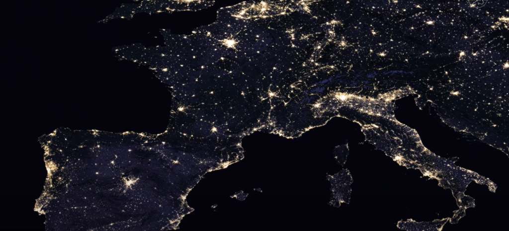
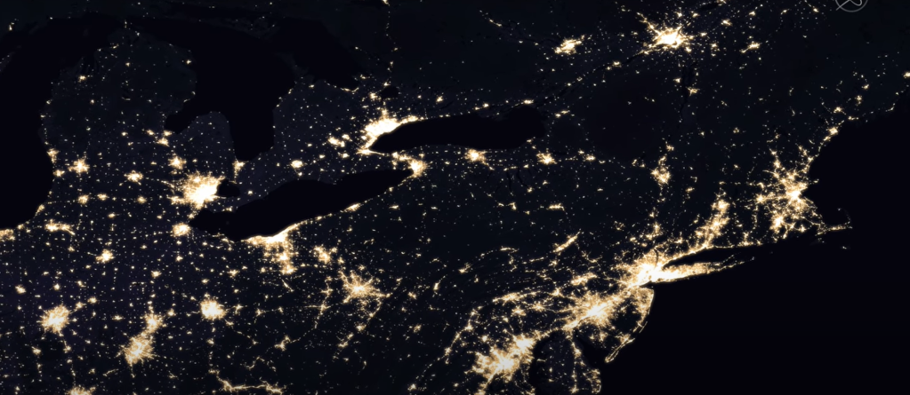
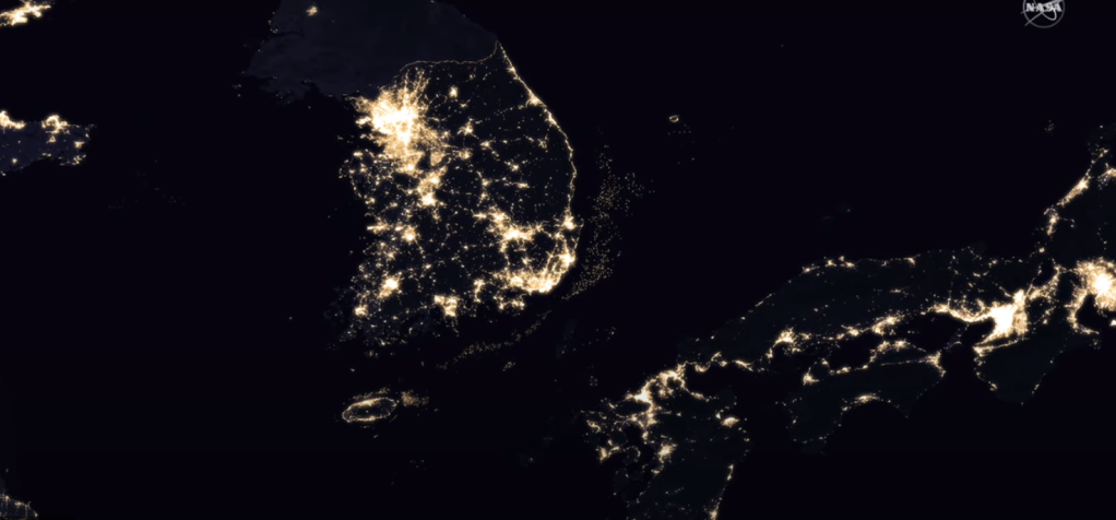


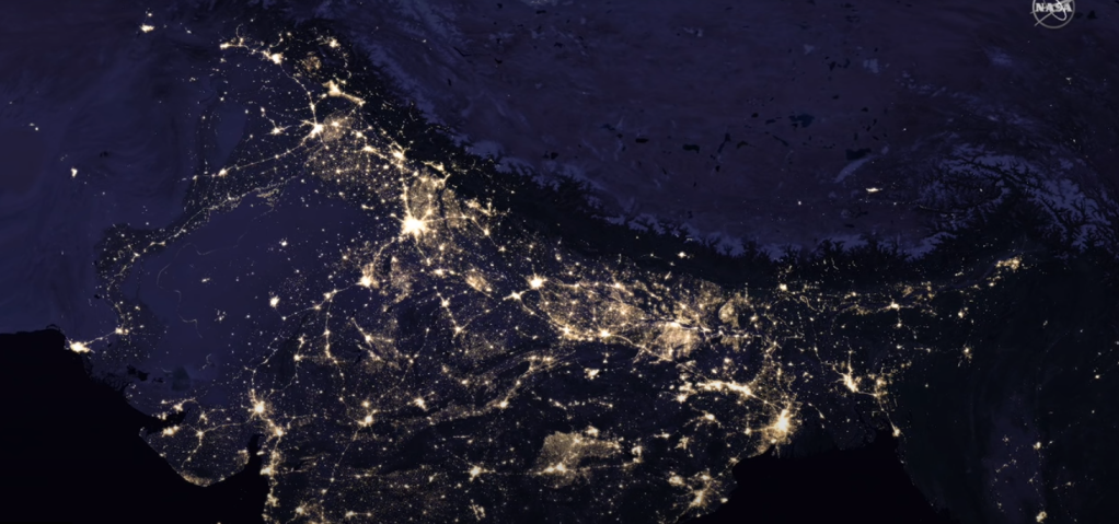

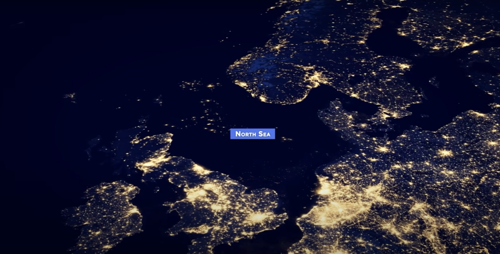
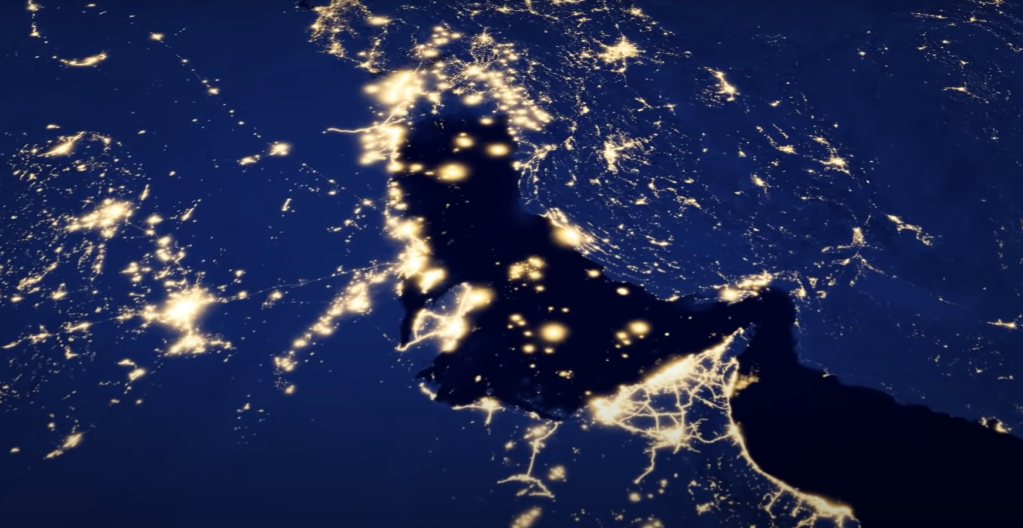

There are numerous fascinating phenomenon’s you can clearly make out by viewing these images/maps:
- How well lit the borders are between Pakistan and India, and North and South Korea
- The difference in intensity of lighting between places like North and South Korea
- The 100th Meridian West in the US – this meridian roughly marks the boundary between the dry (semi-arid) climate in the west and the humid continental and subtropical climates in the east. It explains the sparsely populated western part of the US due to the need for heavy irrigation to support agriculture
- Afghanistan’s ring road cities that encircle it’s mountainous and craggy interior – similar situation with Iceland and Australia where the vast majority of its cities/towns are located along the coast
- Perth in Australia is the most isolated big city in the world
- All those oil rigs in the North Sea, or better yet, the Persian Gulf
- The sheer presence of people living along the Nile and Indus Rivers
- Argentina’s perfectly spaced and organized rail road towns
- If you are able to compare the Black Marble Maps from previous years, you can see some dramatic changes in the following places:
- The detrimental impact of the Syrian Civil War (+ISIS/ISIL) on electricity output in Syria and northern parts of Iraq
- The increasing intensity of India’s lights – ensuring electricity reaches every village in the Country was a central issue of Modi’s party platform
- The massive urbanization (rural to urban shift) of China
- Sub-Saharan Africa appears far darker than it should be – not because there is no one living there, but because there are over 600 million people there without access to electricity. Many of the people still rely on solid fuels like wood for heating and light, and thus their presence is not captured by NASA
For more information, you can also explore Google Earth in “night mode” (which allows you to go back in time and compare), and there’s a great video on YouTube that identifies some of the most interesting patterns made by the lights.